As of May 2022 were extremely happy to announce the addition of a brand-new service for our clients in the form of RTK drone mapping.
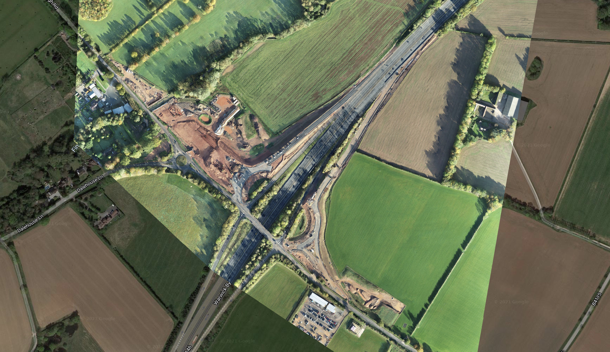
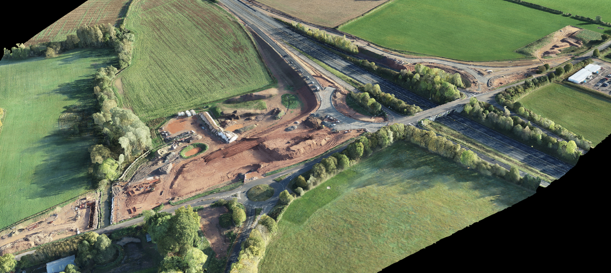
Also known as photogrammetry and orthomosaics this aerial drone based service will help our clients with up-to-date drone satellite images and 3D models for their sites throughout the Midlands and further afield.
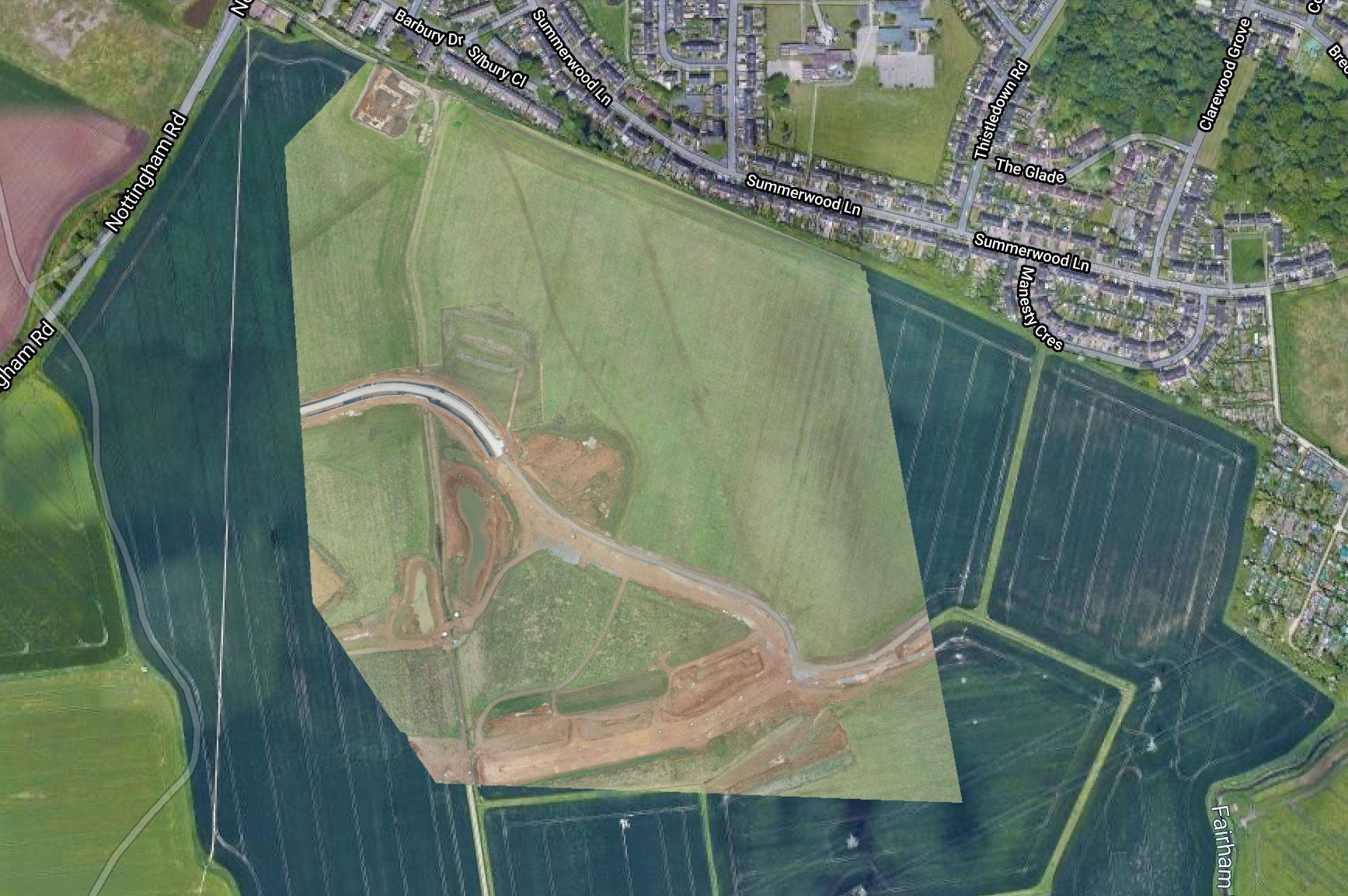
Over the past 12 months we’ve been testing this RTK photogrammetry drone mapping on half a dozen of our clients sites delivering frequent updated satellite images which are used for progress updates and further site planning
Delivering the photogrammetry data in a variety of usable formats depending on our clients requirements. In most circumstances this is in the form of a 2-D Orthomosaic and a 3D point cloud.
If you’re looking for 3-D photogrammetry or 2D photogrammetry satellite images of your construction site don’t hesitate to get in touch using the details on the contact tab at the top of this page
Photogrammetry previously has been extremely complicated and expensive but recent developments in technology have enabled us to deliver this service at a greatly reduced cost when compared to previous technologies.
With accuracy down to 20 mm for the 3-D Point cloud this has become a more cost-effective option and enables our clients together incredible amounts of data in a short period of time. Perfect for initial topography data gathering when initially working onsite.
Usages vary geatly across a wide range of professions. From civil infrastructures to highways agencies, real estate developers and land planning companies the list really does go on and on.
In 2022 now with 12 months data capturing experience we are launching this is a brand-new service something that we are proud to have tested and see the huge benefits our clients are achieving with this new satellite imagery.
The great news is we don’t need power on site and we can capture this data completely independently with no requirements for our client to be there. As long as we have access to their land and permission for our work to take place.
As always air-traffic control requirements need to be adhered to and if you are located near any military or civilian aerodromes or airports we will need to do the appropriate work required for our flights to be authorised.
How much does this cost? Dependent on the size of the site will depend on the data collected the time required, costs will vary depending on the specific projects requirements.
If you would like us to quote a project for yourself we request that you send through a contact form here. We will require a short telephone call this will enable us to do an initial assessment of your requirements allowing us to deliver an indicative cost over to you usually within 24 hours.